Recent Storm Damage Posts
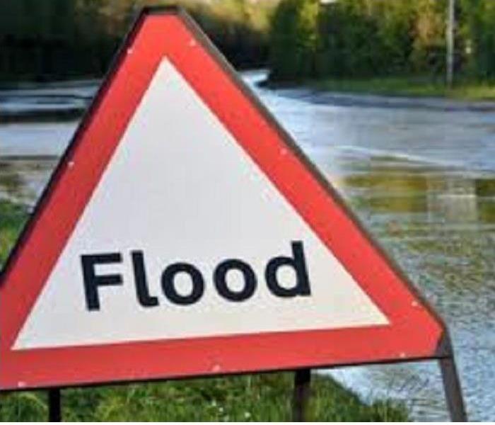
Storm or Flood Damage
9/27/2024 (Permalink)
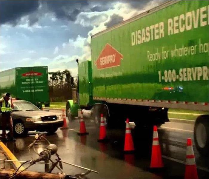
SERVPRO of the Quad Cities specializes in storm and flood damage restoration. Our crews are highly trained and we use specialized equipment to restore your property to its pre-storm condition.
Faster Response
Since we are locally owned and operated, we are able to respond quicker with the right resources, which is extremely important. A fast response lessens the damage, limits further damage, and reduces the restoration cost.
Resources to Handle Floods and Storms
When storms hit Muscle Shoals, we can scale our resources to handle a large storm or flooding disaster. We can access equipment and personnel from a network of 1,650 Franchises across the country and elite Disaster Recovery Teams that are strategically located throughout the United States.
Have Storm or Flood Damage? Call Us Today 256-383-4470
SERVPRO Restores Your Property to Pre-Storm Condition
9/12/2023 (Permalink)
SERVPRO of the Quad Cities specializes in storm and flood damage restoration. Our crews are highly trained and we use specialized equipment to restore your property to its pre-storm condition.
Faster Response
Since we are locally owned and operated, we are able to respond quicker with the right resources, which is extremely important. A fast response lessens the damage, limits further damage, and reduces the restoration cost.
Resources to Handle Floods and Storms
When storms hit Muscle Shoals, we can scale our resources to handle a large storm or flooding disaster. We can access equipment and personnel from a network of 1,650 Franchises across the country and elite Disaster Recovery Teams that are strategically located throughout the United States.
Have Storm or Flood Damage? Call Us Today 256-383-4470
Tips For Flooding After A Storm
9/8/2022 (Permalink)
 SERVPRO Responding to Your Flood Damage
SERVPRO of the Quad Cities specializes in storm and flood damage restoration. Our crews are highly trained, and we use specialized equipment to restore your property to its pre-storm condition.
Several tips are listed below on what to do after storm flooding:
- Remove excess water by mopping and blotting.
- Wipe excess water from wood furniture after removal of lamps and tabletop items.
- Remove and prop wet upholstery and cushions.
- Place aluminum foil or wood blocks between furniture legs and wet carpeting.
- Turn air conditioning on for maximum drying in summer.
- Remove colored rugs from wet carpeting.
- Remove art objects to a safe, dry place.
- Gather loose items from floors.
Since we are locally owned and operated, we can respond quicker with the right resources, which is extremely important. A fast response lessens the damage, limits further damage, and reduces the restoration cost. Our highly trained technicians are ready 24 hours a day, 7 days a week, to respond immediately to flood or water damage.
Activities During a Power Outage
9/2/2022 (Permalink)
 Activities for a Power Outage
Due to severe storms at one time or another we will experience a power outage. Keeping yourself and your kids busy can be a chore. Listed below are activities to keep everyone occupied:
- Get out the board games. Often, we are too caught up in the hustle and bustle to enjoy actual family time. Seize the moment and enjoy a board game together.
- Workbooks, puzzles, or coloring books are a great way to relax and pass time. These can be fun for family members of all ages.
- Bring back charades! Playing charades could be a great way to get your family laughing and communicating.
- Get out your instruments and make some music.Have a sing along and perform your own personal concert.
- Use your artistic skills and spend time drawing, painting, or crafting. Make collages, drawings, paintings, or do origami. Or really go big and make some jewelry!
- Exercise or do yoga. Get steps in by walking around the house (you might feel crazy but hey, who cares?) or do some stretching or make up your own work out and have a family boot camp.
- Make a comic book. You could do these individually or together as a family.
- Play hangman or tic-tac-toe. This would be a great way to pass time, especially if you do not have a board game on-hand.
- Play trivia. Make your own questions!
- Do crossword puzzles, Sudoku, or word games. They pass the time and work your brain.
- Show the kids how you played as a kid. Grab extra sheets and pillows to build a fort.
- Get out the yarn. Do needlework, sewing, cross-stitch, crocheting, or knitting. You can make a blanket, scarf, hat, or create wall art.
- Visit with friends. Get to know your neighbors. Take a walk, weather permitting.
Don’t forget to repack your kit after each use so that it’s ready again for your next power outage or rainy day!
Also, don't forget that Florence Utilities now has real-time updates of any power outages in Florence, Killen, Rogersville and the rest of their services area.
Visit http://florenceelectricityoutage.com
Is a Windstorm a Tornado?
5/20/2022 (Permalink)
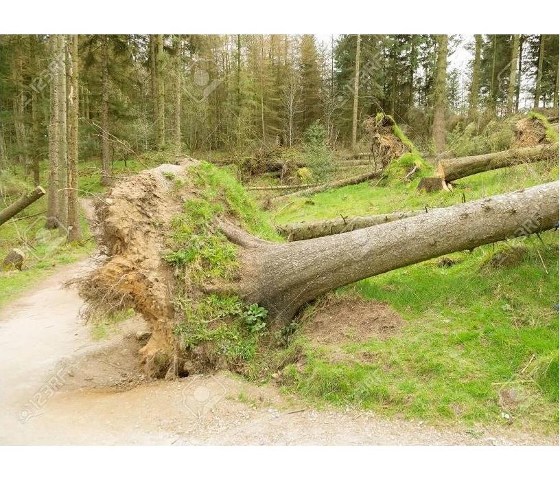
 Windstorm with damage to trees
During a windstorm the winds are strong and violent but without any or little precipitation. Tornadoes carry a violent windstorm by a twisting funnell shaped cloud.
During a windstorm the wind is at least 34 mph that damages buildings and trees. If there is any precipitation it will be light. Windstorm damage is caused by the short bursts of high speed gusts or long periods of sustained winds.
Windstorms can last from a few minutes up to several hours to even days. Wind that travels in a straight line caused by the gust front of an approaching thunderstorm is called a Derecho. The wind in a Derecho can cause widespread damage to the landscape. They can peek at 100 mph and destroy trees and homes.
With wind damage comes roof and window damage. This will allow rainfall to enter the home causing interior and structure damage. SERVPRO of the Quad Cities is here to get your water damage under control. We are highly trained specialist in water and storm damage. We want you to be back in your restored home as soon as possible.
Call you local SERVPRO if you have experienced storm or water damage. We work directly with your insurance by providing the necessary paperwork for a quicker and easier experience. Trust the #1 cleanup and restoration company, SERVPRO of the Quad Cities and more that 1900 other locations.
Ice Storm
1/13/2022 (Permalink)
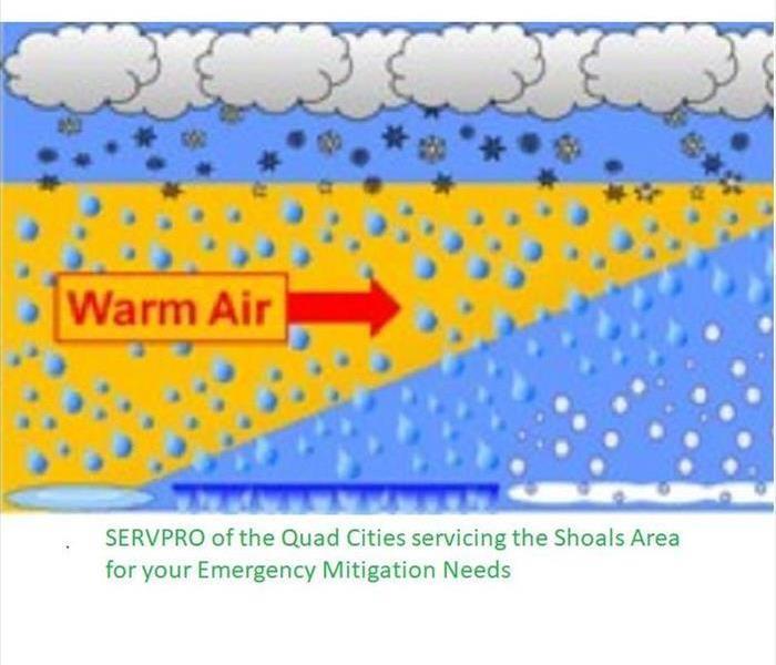
 Ice Storms and SERVPRO Emergency Mitigation
Ice storms are caused by freeing rain. It starts with a layer of warmer air above a layer of sub-freezing temperatures. Frozen precipitation melts to rain while falling into the warm air layer and then becomes frozen again when falling into the cold layer. When the falling precipitation lands on surfaces it becomes a thin sheet of ice. The freezing rain will cover everything with heavy, smooth glazed ice. In the United States, ice storms happen most often in the months of December and January.
When ice falls on trees it can increase their weight by 30 times. This leads to fallen branches and entire trees to fall. This can cause roads to be blocked, tear down power lines and utility poles. This can lead people to be without power for days to weeks. Winter storms have been referred to as deceptive killers by the National Weather Service. Deaths are indirectly related to ice storms due to car crashes and death from prolonged exposure to the cold. It is recommended to stay inside for warmth and allow your pets to be inside or well taken care of if remaining outside.
Ice storms must be at least 0.25-inch of ice on exposed areas to be considered an ice storm. They are more common than blizzards and average 16 per year. Urban areas suffer the most due to the concentration of utilities and transportation systems. Each of these can be affected greatly by an ice storm and costing billions of dollars in repairs. Businesses are directly affected by the outages and can suffer significant loss.
No matter the weather or what Mother Nature brings our way, SERVPRO of the Quad Cities is here 24/7 to assist. We offer board up and roof tarping due to any damage sustained from the freezing precipitation. During the freezing weather pipes can easily freeze causing water damage to your property. We offer quick service so the structure of your home and contents do not suffer any further damage. This saves you as the homeowner on further repairs and out of pocket expenses. We work directly with your insurance carrier to speed the mitigation process along. Damage to your home is stressful enough so let your local SERVPRO of the Quad Cities oversee your mitigation needs due to weather related loss.
What is a Hailstorm?
10/29/2021 (Permalink)
 Hailstorms associated with severe weather
Hailstorms are formed when raindrops are carried upward by thunderstorm updrafts into extremely cold areas of the atmosphere and freezes. The hailstones grow by colliding with liquid water drops that freeze on the hailstone’s surface. The hailstones fall when the thunderstorm’s updraft can no longer support the weight of the stone. Wind driven hail can tear up siding on houses, break windows on cars and cause severe injury to people and animals. The speed of hail falling depends on the size of the hailstone the local wind conditions. Hailstones that you typically see in a severe thunderstorm are 1 inch to 1.75 inch in diameter and fall speed is between 25 and 40 mph. Hail is considered a type of precipitation but falls as a solid.
Nebraska, Colorado, and Wyoming have the most hailstorms. The largest hailstone recovered in the United States fell in Vivian, South Dakota on June 23, 2010. The stone was 8 inches in diameter and a circumference of 18.62 inches. It weighed 1lb and 15 oz. Most hailstorms are made up of different sizes and only the larger ones pose a risk to people. You have heard people say hail is a sign of a tornado. Hail, or any pattern of rain, calmness, or lightning is not a way to rely on predicting a tornado threat. Severe thunderstorms can produce destructive hail without a tornado. Hail caused $1 billion in damage to property and crops each year.
If you are caught outside during a hailstorm, seek shelter immediately in a sturdy building. Stay away from windows, skylights, and do not go outside until the hail has stopped. If you caught in a vehicle turn away from the windows and protect your eyes. The vehicle should provide sufficient protection from the storm. As with any storm take precautions and stay weather alert. Hail has formed due to instability in the atmosphere and severe weather can be present or forming.
When preparing your emergency contact list add your local SERVPRO of the Quad Cities. You can depend on an immediate response from our highly trained technicians, who are available 24 hours, seven days a week.
Fall Severe Weather
10/27/2021 (Permalink)
 Fall brings 2nd wave of Severe Weather.
During the fall season the jet stream starts to shift southward in response to the Northern Hemisphere cooling off. This leads to a second severe peak in weather. The storms in fall can be just as severe as they are in the spring. With these storms can come high winds and down pours that cause flooding. The Southern United States is the area of greatest concern for server weather in the fall. The most severe weather is located from Teas to Georgia. Other areas of concern are in the central Plains and the Mississippi Valley.
The risk of severe weather from tropical systems diminishes during the fall due to hurricane season coming to an end in November. Fall severe weather season in Alabama typically runs from the beginning of November until mid -December. This weather system can sometimes start as early as October and run into the month of December. Most storm-related damage occurs with severe thunderstorm winds. We should keep in mind that severe weather can happen at any given time and always remain prepared. Treat a severe thunderstorm warning as you would a tornado due to the potential of strength and destruction it can bring.
SERVPRO of the Quad Cities and their professionally trained technicians are prepared year around for storm damage. We operate 24/7 for your emergency needs either from flooding from downpours to fires caused by lightning. Our highly trained crews have the specialized equipment and resources to handle the job, large or small, residential, and commercial.
Preparing for the Winter Season
9/16/2021 (Permalink)
 Staying Safe by Preparing.
The winter forecast looks like Alabama with most of the southern states will see a chilly winter. With the chilly weather there is going to be mixed precipitation. Look for this 2021 - 2022 winter to bring below average temperatures.
Winter begins on December 21st with a long-range forecast that suggests that March could be more like winter than spring. Not only does the beginning of cold weather bring cold temperatures, but tornadoes can also be an issue. Tuscaloosa has a second tornado season from November to early December. Tornadoes are most likely to occur between 3 p.m. and 9 p.m. but can occur at any time. Alabama is right in the center of the hot zone for tornadoes and oftentimes referred to as Dixie Alley.
Not only will Alabama be preparing for cold winter months but the threat of tornadoes in the months of November and December. Start preparations early and be in front of bad weather before it hits. Winter preparation for your home includes weather stripping, caulking where needed, and insulation to keep the chill out. Get your outside pipes prepared for freezing temperatures before it gets cold. With freezing weather comes the possibility of ice storms that cause trees and power lines to fall. When this happens, the power is usually disrupted, and you will need supplies in case you are home bound for several days.
Being prepared and weather aware are essential keys for the safety of yourself and your home. Have a way to stay weather alert and be notified by your local agencies on openings and closings in your area.
During any bad weather and damage sustained to your home, SERVPRO of the Quad Cities is prepared for your emergency mitigation needs. Seasons and weather are unpredictable, but your local SERVPRO is your trusted 24/7 emergency response team. Our trained professionals are ready and equipped and prepared to weather any storm!
Flash Flooding
9/9/2021 (Permalink)
 Flash Flooding Warning means NOW!
If heavy rain has fallen over a long period of time river flooding can occur and last for weeks or longer. Some floods are seasonal and with spring rains and melting snows the rivers can fill quickly. Hurricanes and tropical storms are another source of flooding in the summer and fall.
Flash floods come when the rain is heavy. The flash flooding can occur in mountain streams, canyons, or dry washes. Cities and suburbs can have flash flooding in low spots. Sometimes with the amount of rainfall the water can not sink into the ground and will rush down stream and fill up banks causing overflow.
When a flash flooding warning has been issued in your area it means there is flooding now. Stay away from low lying roads and low spots during the flooding. Two feet of moving water is enough to sweep a car or truck away, uproot trees, wash out roads and bridges can start to tumble.
If you are caught in a flash flood, do not drive over or through a flooded bridge or road. Back up and try a higher route. If your vehicle is surrounded by water, get out and seek higher ground. If you are stranded in a tree or building, don't leave it to enter the flood water.
Some of the flood water collects in large, underground reservoirs, but most of it forms rivers and streams that flow into the oceans, bringing the water back to its starting point. Completely drying out a flood can take anywhere from twelve hours to a few weeks, depending on the size of the flood.
Floodwaters are contaminated because they carry sewage and other pollutants. This type of contaminated water is commonly referred to as brown or black water.
Floods are the most common natural disaster in the United States. You need to have a plan for your household and your pets. Make sure your family knows what to do, where to go, and what you will need to protect yourselves from flooding. Practice evacuation routes, shelter plans, and flash flood response. Gather supplies, including non-perishable foods, cleaning supplies, and water for several days, in case you must leave immediately or if services are cut off in your area. Flooding can happen suddenly and being prepared will save time and possibly lives. Stay weather alert and do not return to hazardous situations until your area has been cleared.
Tornado Myth and Folklore
5/27/2021 (Permalink)
 Truth or Myth
Knowing what advice to follow during a tornado can be confusing depending on what advice we have been given. Folklore and Myths stay around for many years and are handed down to generation after generation. The saying, “Grandmother knows best”, is a rule we still follow. Folklores and Myths are tales and sayings that we believe and still practice because our ancestors did. When it comes to safety, we need to know the difference between truth and myth. In the year of 2020 there were a total 1,248 tornadoes reported in the United States. The year 2021 has a forecast of a slightly above normal chance of tornado activity. The expected range is between 1,350 – 1,500 across the United States.
The top 5 Myths of Tornado Safety:
- Opening windows will equalize pressure – this myth is useless, and a waste of time A tornado will blow debris into the home and if hit by the force the windows will break anyway.
- The southwest corner of a basement is the safest corner - No basement corner is safer that the other. The myth came about because people thought tornadoes came from the southwest and the debris would be deposited in the northeast corner. Fact is that tornadoes can arrive from any direction. Choose a place in the basement with no windows or heavy objects on the floor above you.
- The best place to hide out is under a bridge if caught in a tornado on the road – This myth is dangerous and can pull you into the tornado itself. The winds can send debris underneath the structure or cause it to collapse.
- Tornadoes never cross hills or rivers – Tornadoes are not guided nor repelled by hills or bodies of water. It has nothing to do with the topographical features.
- Tornadoes avoid big cities – Many cities including Dallas, Atlanta, and St. Louis have been hit by Tornadoes. Cities occupy a smaller area than the surrounding rural areas and are less likely to be hit. Damage in cities can be far worse due to the number of people and structures. In 2011, Birmingham and Tuscaloosa in Alabama sustained severe damage from a tornado in April of 2011. This tornado was on the ground for 80 miles and an EF-4 strength.
- A green sky means a tornado is coming – the green color is from water droplets suspended in the storm absorbing red sunlight and radiating green frequencies. The green color does indicate the storm is severe though.
During severe weather and tornadoes, the best advice is to follow safety guidelines set forth by your state, local and tribal officials. Stay tuned to your local weather station and use your NOAA Radio. Protect your Family, Pets and animals and your home with Facts and not Myths. Prepare before severe weather sets in and know your safe place. Tornadoes can strike at anytime and come from any direction causing destruction and possible life- threatening injuries.
Know that your local SERVPRO of the Quad Cities is no Myth or Folklore. We have been serving the Shoals area since 1997. SERVPRO provides 24-hour emergency services for homes and businesses. Our mission is to be the premier restoration company in the industry. Choose SERVPRO of The Quad Cities, a local company that specializes in storm and flood damage restoration. We are always here to help and ready to respond to storm and flooding conditions in our Shoals area.
What is a Thundersnow?
1/8/2021 (Permalink)
 Thundersnows are rare and can produce deadly lightning and extreme cold weather
Thundersnow refers to a snowstorm that produces thunder and lightning. Depending on the conditions, the precipitation might be freezing rain or hail instead of snow. To get thundersnow, you need a mass of cold air on top of warm air, plus moist air closer to the ground. The air layer closer to the ground needs to be warmer than the layers above, but still cold enough to create snow. During this event, heavy snowfall is to be expected. Some areas have reported two inches of snow per hour.
The thunder and lightning are different during a Thundersnow than in a thunderstorm. Snow muffles sound, so thundersnow thunder sounds subdued and does not travel as far. Lightning flashes are enhanced by reflective snow. Thundersnow lightning appears white or golden and have a positive charge. This lightning is more destructive than usual negative polarity lightning and can cause a fire or damage to power lines. The conditions that lead to a Thundersnow can also lead to dangerous cold temperatures and poor visibility. Tropical force wind is possible as with a blizzard. While these events are rare, the following locations have more favorable conditions to produce such a storm:
- Great plains
- Mountains
- Coastlines
Although our area is not likely to see a Thundersnow, we can still experience the effects of snow and freezing rain. Winter weather can be as unpredictable as summer storms. Freezing rain can cause power lines to fall as well as trees and road hazards. The one predictable thing during weather events is your local SERVPRO of the Quad Cities. We are prepared and servicing our area under all weather conditions. Locally operated and available for your service needs 24/7. If you have experienced storm damage call today for your inspection and estimate on restoration needs. We work with our customers to ensure complete customer satisfaction.
How a Jet Stream predict storms
10/30/2020 (Permalink)
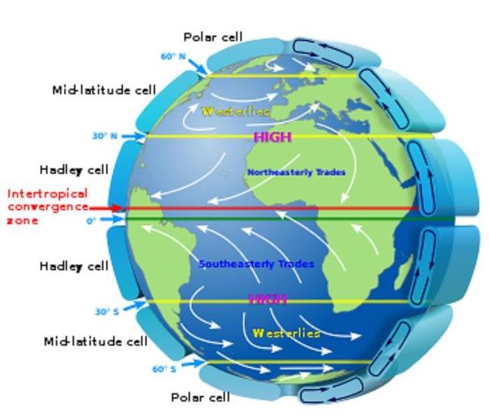
 Model of Jet Stream, cell, latitude, temperature
Jet streams play a key role in determining the weather due to the separation of colder and warmer air. They generally push air masses around, moving weather systems to new areas and causing them to stall. The stream is an area of strong winds ranging from 120-250 mph that can be thousands of miles long, a couple of hundred miles across and a few miles deep. The jet streams form when warm air masses meet cold air masses in the atmosphere. On Earth, the main jet streams are located near the altitude of the tropopause and are westerly winds. Their paths typically have a meandering shape.
Jet streams are the major means of transport for weather systems. Without a jet the whole pattern of global temperatures would be different. The air would cool much more gradually across the latitudes. The striking temperature difference between the equator and poles would be gone. The sun does not heat the Earth evenly causing area near the equator to be hot and those near the pole to be cold.
The earth’s rotation is responsible for the jet stream as well. The spinning nature of the earth accentuates these changes. Storms are guided in a generally west-to-east fashion due to jet streams. The weather would change very little without it. Although many factors combine to influence weather, the four main ones are solar radiation, latitude, temperature, and air pressure. The two jet streams that directly affect our weather in the continental US are the polar jet and the subtropical jet. They are responsible for transporting the weather systems that affect us.
If you can predict the path of the jet stream, the upper atmosphere’s undulating river of wind, then you can predict weather. The jet stream can be a prediction for an entire season. Storms ride along the stream and when it shifts so does the area where the storms are the strongest.
Having ways to predict weather can better prepare us for strong storms and flooding. With preparation leads to less cost on home repairs and a weather ready home. Although disasters will happen, and unforeseen damage will occur your SERVPRO of the Quad Cities is always Storm Ready. Professional highly trained technicians are ready to assist in your mitigation and restoration emergencies. Call today for your inspection and estimate on any storm damage your home may have received. Faster to any Disaster saving your home from further damage. SERVPRO of the Quad Cities nearby and ready to help with 24/7 service.
Winter Weather Prediction
10/29/2020 (Permalink)
 Wet Winter Predicted for Alabama
Winter during which there is a La Nina tends to have certain characteristics across the United States. We are just two storms away of tying the record number of tropical storms set back in 2005. We still have until November 30 for hurricane season to be over. If La Nina continues into the spring of 2021 it can contribute to severe thunderstorms and tornadoes across the central United States. The Spring months would include March through May.
The Farmers' Almanac has released their winter 2020-2021 forecast, calling it the “Winter of Great Divide” across the United States. The fall was indicated with cooler temperatures slowly moving in all regions. According to the Farmers' Almanac, Alabama's winter weather for 2020-2021 is expected to be chilly and rainy.
Tracking La Nina and the Farmers’ Almanac can help prepare a homeowner for upcoming weather conditions. Knowing our winter could carry a lot of rainfall indicates flooding. Make sure any leaks have been addressed and the surrounding area around your foundation is stable. Gutters should have already been cleaned out for the second time this year. This will allow any rainwater to be directed away from your home.
As a homeowner our responsibility is to protect our investment from indoor and outdoor hazards. At SERVPRO of the Quad Cities it is our responsibility to our customers to restore and mitigate your property back to normal conditions before any disaster occurred. We have highly trained technicians in water and storm restoration. If the rainy winter weather has caused havoc to your home reach out to your local SERVPRO.
No matter what steps we take to protect our property unforeseen damages can occur. Winter storms brings cold weather and frozen pipes. Rainy winter weather can cause flooding, roof leaks and soil erosion. Take the necessary steps to protect your property and leave any emergency mitigation to SERVPRO of the Quad Cities.
Hurricane Category
9/18/2020 (Permalink)
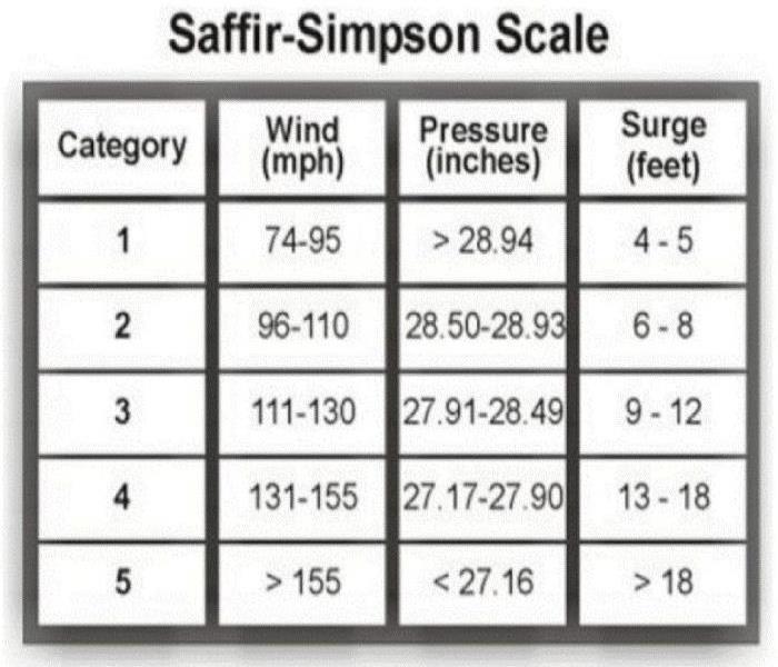
 Hurricane Saffir-Simpson Scale
Each year on average, 10 tropical storms develop over the Atlantic Ocean, Caribbean Sea, or Gulf of Mexico. About five hurricanes strike the United States coastline every three years. Of these five, two will usually be major hurricanes. The Saffir-Simpson Scale can be used to give an estimate of the potential property damage and flooding expected along the coast because of hurricane activity. Each category includes wind speeds and expected effects. Listed below is what can be expected by category of a Hurricane.
- Category One
Wind Speed 74 - 95 mph - Effects: No real damage to building structures. Damage primarily to unanchored mobile homes, shrubbery, and trees. Also, some coastal road flooding and minor pier damage.
- Category Two
Wind Speed 96 - 110 mph - Effect: Some roofing material, door, and window damage to buildings. Considerable damage to vegetation, mobile homes, and piers. Coastal and low-lying escape routes flood 2-4 hours before arrival of center. Small craft in unprotected anchorages break moorings.
- Category Three
Wind Speed 111 - 130 mph - Effect: Some structural damage to small residences and utility buildings with a minor amount of curtain wall failures. Mobile homes are destroyed. Flooding near the coast destroys smaller structures with larger structures damaged by floating debris. Terrain continuously lower than 5 feet above sea level (ASL) may be flooded inland 8 miles or more.
- Category Four
Wind Speed 131 – 155 mph - Effect: More extensive curtain wall failures with some complete roof structure failure on small residences. Major erosion of beach. Major damage to lower floors of structures near the shore. Terrain that is continuously lower than 10 feet ASL may be flooded requiring massive evacuation of residential areas inland as far as 6 miles.
Category Five
Wind Speed 155 mph – or greater
- Effect: Complete roof failure on many residences and industrial buildings. Some complete building failures with small utility buildings blown over or away. Major damage to lower floors of all structures located less than 15 feet ASL and within 500 yards of the shoreline. Massive evacuation of residential areas on low ground within 5 to 10 miles of the shoreline may be required.
After the Storm
If you have weathered the Storm and have damage leave the clean up to the professionals. As a leader in storm and water damage restoration, SERVPRO of The Quad Cities has the specialized training and expertise to restore your home back to its pre-storm condition. Our restoration process puts an emphasis on scientific drying techniques, progress monitoring and documentation. With over 1700 Franchises we are prepared for catastrophic storms and major events.
Second Peek of Severe Weather ahead
9/10/2020 (Permalink)
 SERVPRO is ready!
Autumn is around the corner and with the changing season, heightened risk of severe weather will begin. The second peak of severe weather happens in the Fall due to the shift of the jet stream. It starts to shift southward in response to the Northern Hemisphere cooling off. The thunderstorms that form can be just as severe as Spring thunderstorms. They can produce the threat of tornadoes, damaging winds, and flooding.
The Southern United States is the area of greatest concern for severe weather in the fall. Cold fronts driving from the north collide with warm, humid air originating in the Gulf of Mexico. Texas to Georgia are the most common areas for severe weather during the fall. Occasionally the central Plains and Mississippi Valley will have severe weather.
Tropical storms along the Gulf Coast also contribute to the secondary peek of severe weather. The threat diminishes as the hurricane season ends in November. On November 13, 2013, there were 73 tornadoes recorded from Tennessee to Michigan. This severe weather patten proved that any day of the year can be a severe weather threat.
Alabama fall severe weather starts at the beginning of November and ends in late December. Know your safety plan and be able to pinpoint your location on a map. Learning your surrounding counties and communities will allow you to be more prepared on direction of threat.
SERVPRO of the Quad Cities is ready to respond if you are dealing with storm, flood, or water damage from thunderstorms. Since we are locally owned and operated, we have prepared for expected damage from flooding and are able to respond quickly. When preparing an emergency contact list do not forget to add your Local SERVPRO phone number and contact!
Severe Weather during a Pandemic
5/29/2020 (Permalink)
 Planning for Severe Weather during a Pandemic
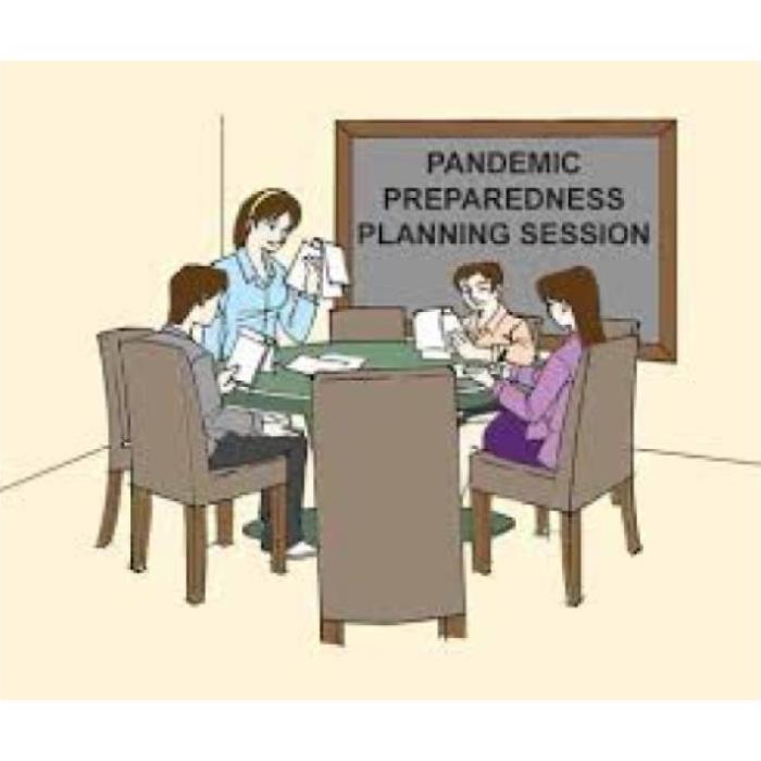
When dealing with severe weather during a Pandemic it can be very stressful. When planning give yourself more time to prepare.
- Pay attention to your local guidance regarding updated plans for evacuations and shelters
- Prepare a "go kit" with personal items you cannot do without
- Prepare your emergency food, water, and medicine supplies
Make sure you pay attention to local guidelines about updated evacuations and shelters. Some of your local shelters may be closed or have a smaller capacity due to the spread of germs. If you need to go to a disaster shelter be sure to follow CDC recommendations for staying safe and healthy in a public disaster shelter during a pandemic.
During the event of an evacuation prepare a “go kit” with personal items you cannot do without during an emergency. Include items that can help protect you and others from viral health risk. Protective items should include hand sanitizer, or bar or liquid soap if not available, and two cloth face coverings for each person. Face covers should not be used by children under the age of 2. They also should not be used by people having trouble breathing, or who are unconscious, incapacitated, or unable to remove the mask without assistance.
Understand that your planning will be different during a pandemic. It may take longer to restore power and return home after a severe weather event. First responders and hospitals are already overwhelmed with patients. Make sure you have adequate supplies for your size of family and their unique needs. Medications should be filled, enough water and food for 14 days and a reliable source to stay informed.
When returning home and you find yourself in need of repairs, water mitigation or cleaning and disinfection to limit the survival of emerging viral pathogens call your local SERVPRO. We at SERVPRO of the Quad Cities are prepared to clean and disinfect your home or business, according to protocols set forth by the Centers for Disease Control and Prevention. We have years of experience in dealing with biological contaminants, and we adhere to the highest cleaning and sanitation standards.
Supercells
1/10/2020 (Permalink)
 Supercell capable of producing damaging winds, hail and tornadoes
Supercells are storms that contain updrafts that rotate about a vertical axis. This rotation is derived from shear in the environmental wind field surrounding the storm as it begins to grow. Supercells often produce damaging wind, large hail and tornadoes. Most of the strongest tornadoes are associated with supercells.
A supercell requires several very unique factors coming together in order to see one form. All thunderstorms require moisture, instability and lift to form. Supercells require the same ingredients but must have wind shear as well to form.
- Moisture: adequate amount of moisture has to present in order for a supercell to form. On the Plains, the base line for good supercell thunderstorms is usually 50F. For supercells to be tornadic, the base line figures are usually dew points of 55F on the High Plains and 60F for the lower plains. These vary setup to setup though.
- Moisture:Supercells require adequate moisture to be present in order to form. Instability and Lift: Unstable air is air that tends to rise when it is lifted. For air to rise, it has to be hotter than the air surrounding it, think about the old saying ‘hot air rises’. That saying is true for the atmosphere as well. Unstable air occurs when the air at the surface is warmed beneath cooler temps aloft. The faster the air tends to rise, the more unstable the atmosphere is.
- Wind Shear: Supercells need to have the updraft rotating, this is accomplished through wind shear or wind which veers and speeds up with height.
If a storm that meets these criteria is possible for an area, the Storm Prediction Center will issue a severe thunderstorm watch or a tornado watch. If a storm with these criteria is imminent, your local Weather Service office will issue a severe thunderstorm warning or a tornado warning.
Over time (usually an hour or two), the supercells will completely break down and form into a strong line of thunderstorms. Since supercells usually form in the central Plains during the late afternoon hours, the supercells merge into a line by the late evening and nighttime hours and the line starts to race eastward. This is why parts of the south (especially Arkansas) often see a good portion of their severe weather in the middle of the night.
With the intensity of these storms getting prepared and remaining weather alert can save lives and property. Stay tuned to your local news or NOAA Weather Radio for emergency updates. If you have made outdoor plans move the activities to an inside location.
Make plans to stay with a relative or friend if the structure of your home is not sustainable for high winds. Mobile homes can blow over with high winds. Arrive at your safe place well in advance to avoid being caught in your vehicle. If you are driving pull over and stay in your vehicle. Make sure your emergency flashers are on so are visible.
If your home or business is impacted by storms and emergency service is needed, SERVPRO of the Quad Cities is available 24 hours 7 days a week. Our professionals are trained and equipped to provide your mitigation and restoration needs. Serving our community and restoring loss to your property!
Derecho Storms
10/31/2019 (Permalink)
 Black Shelf Cloud, cloud beneath storm,Derecho approaching
Derecho Storms
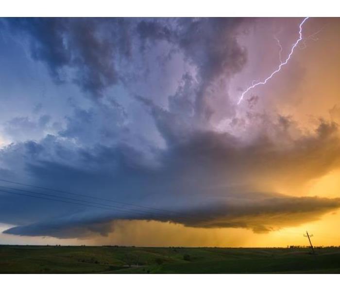
Derechos are home to the most incredible shelf clouds nature can produce. A shelf cloud is a thick cloud that juts down from the sky, like a shelf hanging beneath the bottom of the storm. There are two different types of derechos. The most dangerous type is a progressive derecho. This is the kind of storm you see in the summer that speeds across entire states and leaves tornado-like damage in its wake. A serial derecho forms along a cold front. Serial derechos are most common during the fall and winter months.
Derechos are associated with bands of rapidly moving showers or thunderstorms variously known as bow echoes, squall lines, or quasi-linear convective systems. The winds associated with derechos are not constant and may vary considerably along the path it takes. Sometimes the winds are below severe level reaching 57 mph or less. Severe winds from this storm can be from 75 mph to greater than 100 mph.
Derechos are most common in the central United States, but they can form just about anywhere around the world that experiences severe thunderstorms. A relentless summertime heat wave can trigger multiple derechos in one week if conditions are just right. They can leave behind more damage than a tornado, yet they're relatively unknown by anyone other than weather enthusiasts.
One of the reasons derechos can wreck such havoc is because they come on suddenly. There usually isn’t much of a buildup to the strongest winds before they hit. Conditions can go from calm to chaos in a matter of seconds. The abruptness with which the winds can hit can even snap off the tops of trees.
The aftermath of many derechos looks like what you would see after a hurricane or tornado. The winds destroy roofs, structures, barns and can cause wide spread power outages. The storm can produce wind damage over 200 miles long and last over 6 hours.
Those involved in outdoor activities during the hot summer months are at a greater risk. Campers or hikers in forested areas are vulnerable to being injured or killed by falling trees. Occupants of cars and trucks also are vulnerable to falling trees and utility poles. Even those indoors may be at risk from falling roofs. Mobile homes in particular may be overturned or destroyed.
Derechos are very powerful, destructive wind storms. The derecho initially starts as a cluster of storms that forms a squall line. This line of storms can eventually show a bowing structure, indicating stronger storms and more concentrated winds in those areas. During the summer months when storms are predicted stay weather alert and move your activities inside if any way possible. These storms are fast moving and approach suddenly.
How to Prepare Your Car for a Storm
10/30/2019 (Permalink)
 Items to put in your Emergency Supply Kit
How To Prepare Your Car For A Storm
Having your car prepared will help you get home safely or wherever you need to go, when the weather is bad. In case you can not get home due to road closures or storm damage to your home, you will have emergency supplies available.
Keep your car in good condition by checking the tires, oil and water. Make sure the lights and windshield wipers are in good working condition. You do not want to find yourself stranded in the middle of a storm. Ensure that your car has at least a half a tank of fuel in case the gas stations are closed.
First aid and emergency kits should consist of a multi-tool, flashlight and batteries and a visible jacket. Any medication your family is taking should be included along with general pain medication.
Keep an external battery charger fully charged for your cell phone, gps and other devices in the event you can not get home. Store a map as well in case there is no service available for gps. Marking safe areas, motels and alternative routes in advance can save time and the worry of not being able to get home or to a safe location.
Keeping warm clothing such as waterproof clothes and boots is a good idea in case you have to abandon your car to walk. It may be quicker to leave the car to walk to a nearby motel than trying an alternate route. Abandoning your car should not be undertaken lightly.
Cash on hand is recommended in case fuel, food or provisions need to be purchased. During a storm the ATM may be out of service. Have additional food and water in case there is a need to stay over night in your car. Make sure you have proper food for nutrition. Having snacks available for children can keep them happier when having to spend an extended amount of time in a car.
Keeping tools in your car will help assist with tires that may need to be replaced, changing bulbs or a shovel for digging. Your emergency car kit should include items that can be put outside of your car to allow other oncoming traffic to visually spot you such as triangles.
Having the most important phone numbers you need in the car is recommended. If your cell phone can not be charged or service is lost you will have a hard copy. Be sure to include your home owners and car insurance policy with emergency contact information.
When we have the tools to wade the storm we come out safer and calmer. Make sure you car has all the recommended tools to keep you and your family safe if ever confronted with an unexpected emergency.
Fall Tornadoes
9/20/2019 (Permalink)
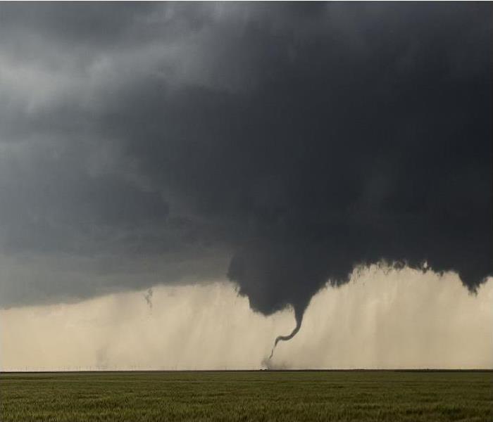
 Tornado touching down in open grassy field.
Fall Tornadoes
The Southern United States has suffered more tornado fatalities than any other part of the country. Some areas experience repeated damaging tornado events, such as the Tennessee Valley and in northern Alabama. The state of Alabama is tied for the most reported F5 tornadoes.
The second half of October and especially November can often be a second season for tornadoes and severe thunderstorms. These months are the counterpart to spring, when strong fronts and upper-air systems march across the United States. When enough warm, moist air accompanies these weather systems, the unstable conditions yield severe thunderstorms and sometimes tornadoes.
In the United States over 80 deaths and 1,500 injuries are associated with tornadoes each year. If you and your family are prepared ahead of time, you’ll be able to take the necessary action steps to survive a tornado and its aftermath.
Tornado safety tips before the storm
1. Be prepared – Tornadoes can strike at any time, 365 days a year, with or without warning. Make sure your family knows your plan of action if a tornado warning is issued for your community. Some things to consider include discussing the best place to take shelter in your home, the difference between watches and warnings, the county you reside in, steps you will take during and after the storm, and creating a safety kit.
Tornado safety tips after the storm
1. If you’re away from your home at the time of the tornado, try to return safely. Listen to news reports to see if you can get up-to-date information about your neighborhood. Watch for fallen debris and power lines, and heed the advice of local authorities.
Staying on top of the weather is imperative. Having a weather radio with a backup battery and a smartphone app is a way to stay notified of alerts and notifications. Keeping safe is taking all alerts seriously and staying in your safe place until they have expired. Remember that tornadoes are possible every single month. Our weather is unpredictable and even thought numerous watches and warnings have not produced a tornado doesn’t mean that each one will have the same outcome. Stay prepared and safe.
How You Can Help Victims of Hurricane Dorian 2019
9/11/2019 (Permalink)
 Helping the Victims of Hurricane Dorian 2019
Hurricane Dorian roared ashore last week with 185 mph winds and heavy rains causing substantial damage to homes in Grand Bahama and Abaco before heading back out to sea, and returning to lash North Carolina’s Outer Banks. The storm was extremely powerful, long-lived, and destructive. Dorian developed from a tropical wave on August 24 in the Central Atlantic. The system gradually intensified while moving toward the Lesser Antilles, before becoming a hurricane on August 28. From August 26 to August 28, the storm affected Caribbean nations and territories devastated by hurricanes Irma and Maria in 2017. Dorian's 185 mph (295 km/h) sustained winds at landfall on Elbow Cay ties it with the 1935 Labor Day hurricane as the strongest landfalling Atlantic hurricane, measured by sustained winds. The true death toll is unknown, but news sources in the Bahamas suggested that it may exceed 3,000. Property damages were estimated at $7 billion for the Bahamas. Damage estimates in the U.S. and Canada are currently unknown
If you want to know what you can do to help out, here are a few tips:
- While you may want to send food and other items, the infrastructure may not support those donations. Many organizations have been clear that cash, or cash equivalent, is preferred.
- Be wary of personal solicitations on your doorstep or over the phone. Make sure that gifts made by checks or credit card gifts are secure. If you don't want to donate online or by text, most organizations have alternatives, like donation forms that you can mail together with a check.
- Check out the credentials of a potential donee/charitable organization before you donate. If you’re looking for a tax break, you can always confirm charitable status through the Internal Revenue Service (IRS) web site using the TEOS Search Tool. Remember that some organizations, like churches, may not be listed on the IRS website, so don't be afraid to ask organizations which don't appear on the list for more information.
- For federal income tax purposes, you can only deduct contributions to qualified tax-exempt charitable organizations.
- Read the fine print before sending money abroad. Details are always important but especially if you’re not familiar with an organization. You can always give to S. charities that provide international aid and still claim a deduction.
- Be sure to document your gifts and get receipts: the IRS requires that you do so for tax purposes and having the information available is handy if you want to follow up with another donation. Never hesitate to ask the charitable organization or your tax professional if you have questions.
If you want to help but aren't sure where to start, tax-exempt charities that have indicated they are accepting Dorian-specific donations include:
- American Red Cross.To make a financial donation, visit org, call 1-800-435-7669 or by mail a donation form.
- Catholic Charities of USA.To make a financial donation, visit CCUSA's disaster-specific website.
- Global Giving. To make a financial donation, visit their website.
- Salvation Army.To make a financial donation, visit helpsalvationarmy.org or call 1.800.SAL ARMY.
- Save the Children.To support Save the Children’s response efforts, visit their website.
- Team Rubicon.To assist a team of military veterans and first responders with their Bahamas response effort, you can make a donation on their website.
- Water Mission.To help provide emergency safe water solutions to people in dire need in the Bahamas, you can make a donation on Water Mission’s website.
- World Central Kitchen.To help Chef José Andrés feed survivors of Hurricane Dorian, visit WCK’s website: wck.org
Be READY for Severe Weather
6/2/2019 (Permalink)
Are you ready for Severe Weather?
Severe weather in North Alabama is unpredictable and SERVPRO® of The Quad Cities wants you to be safe no matter the season! Below are some severe weather readiness tips to help guide you, no matter what type of disaster you may encounter.
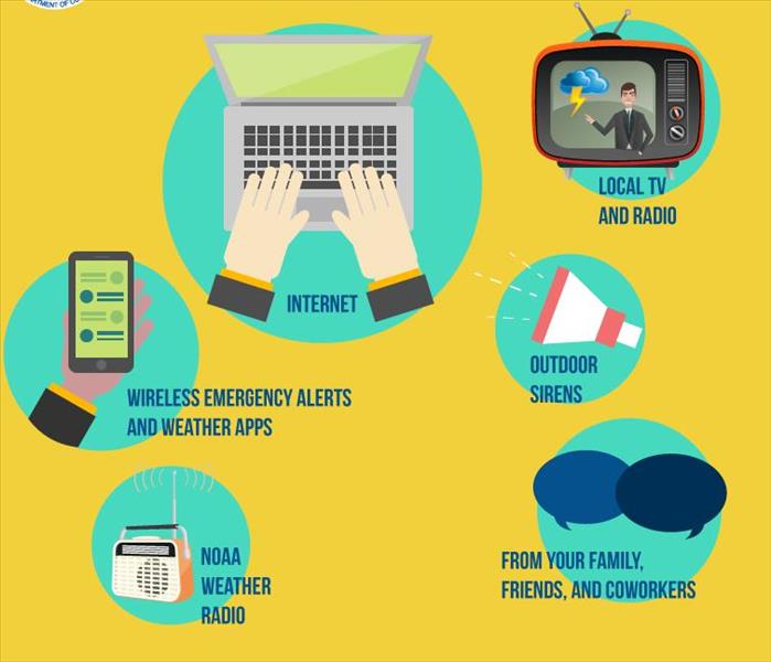
Weather Radios: Weather radios are the most reliable way to receive notifications of severe weather in your area. Although cellular phones, weather apps, social media as well as wireless emergency alerts (WEA’s) are what the majority of us depend on to keep informed, the truth is those devices can have their limitations during severe weather and can be interrupted. Mobile devices rely on towers and those towers can be damaged and cease to function during severe weather. A weather radio, WITH CHARGED BATTERIES, is the most reliable way to be informed of severe weather. Be sure to properly program your weather radio so you only receive the alerts you want for the counties you want.
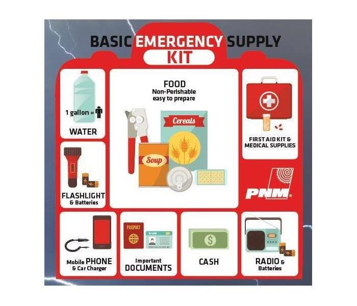
Emergency Supply Kit: Having an emergency kit can be a life saver. Most emergency management agencies recommend supplies for up to three days. The following is a list you can use as a guideline:
- Water – 1 gallon per person per day
- Food – non-perishable
- Manual can opener
- Battery operated radio, preferably a weather radio
- Flashlight
- Extra batteries for radio and flashlight
- Frist Aid kit
- Whistle to signal help
- Clothing, blankets
- Dust mask or bandanas
- Plastic sheeting, garbage bags, and duct tape
- Wrench or other tools to shit off utilities
- Hygiene items
- Important documents. (Copy of insurance policy, bank account info, identification, etc.)
- Fire extinguisher
- Matches in waterproof case
- Cash
Make family plan: Make sure all members in the household are aware where they are to go in the event of severe weather. If for some reason the family is separated in the event of a severe storm, have a meeting place established as to aid in finding each other amidst devastation.
Call SERVPRO® of The Quad Cities at 256-383-4470. We are here to help!
Power Outage Tips
1/16/2019 (Permalink)
Weather-related power outages are a fact of life in North Alabama. Fortunately, most utility departments are able to respond quickly and return power as soon as possible.
Here are some tips to help you get through a power outage.
To Help Preserve your Food During a Power Outage
Keep refrigerator and freezer doors closed as much as possible. First use perishable food from the refrigerator. A full freezer will keep the temperature for about 48 hours (24 hours if it is half full) if the door remains closed. A refrigerator will keep food cold for about four hours if the door is kept closed. Keep the door closed as much as possible. Discard any perishable food (such as meat, poultry, fish, eggs, and leftovers) that have been above 40 °F for over 2 hours.
Protecting Electrical Equipment During a Power Outage
Turn off and unplug all unnecessary electrical equipment, including sensitive electronics. Turn off or disconnect equipment or electronics you were using when the power went out. When power comes back on, surges or spikes can damage equipment. Leave one light turned on so you’ll know when the power comes back on. Turn all other light switches off.
Don’t forget about Carbon Monoxide, Be Careful!
Never use a generator, grill, camp stove or other gasoline, propane, natural gas or charcoal-burning devices inside a home, garage or any partially enclosed area. Locate unit away from doors, windows and vents that could allow carbon monoxide to come indoors.
Be Prepared
It’s always good to be prepared in the event that the power goes out. Your emergency kit should include items such as flashlights, flameless candles, matches, canned foods, water, granola bars, etc.
Types of Storm Damage
11/1/2018 (Permalink)
Here in the Florence/Muscle Shoals area, we can suffer from many types of storm damage. Some of those are wind damage, flood damage, and hail damage. Here are a few quick tips to consider should storm damage hit your home or commercial property.
Wind Damage Restoration
Storms often cause severe wind damage. Your roof is particularly susceptible. Roof damage from strong winds may lift roof shingles, cause cracks, or remove part or all of the roof. Harsh winds and rains can shear away asphalt tiles. Flying debris can also cause cracks and holes in your roof and siding. Correcting roof damage may challenge homeowners and business owners after a disaster, especially because a roof leak may not be obvious.
Roof Leaks
Why are many roof leaks and roof damage hard to detect? The storm may loosen flashing without creating a problem that’s easily visible to the eye. Loose flashing can cause another roof leak even weeks after the initial storm damage. A small roof leak can produce damp, moldy conditions inside your home or business. You best bet is to secure roof repair immediately after the wind damage. Doing so can prevent long term interior damage.
Flood Damage & Recovery
If your home or business is near water or in a low-lying area, flood water damage is a risk. Heavy rains and flooding may cause water damage many miles from the coast or from any large body of water. If the land around your home or business cannot absorb the additional water flooding may happen. Even homes and businesses at higher elevations can sustain flood damage if frozen pipes break. Flood pump failures contribute to basement flooding and contaminated ground water in some locations, too.
Flooding may also disrupt your municipal water system. Experts need to assess ground water and evaluate the condition of pipes following flood damage. Hiring a storm restoration firm, like SERVPRO of the Quad Cities may allow you to begin your cleanup process even before water restoration occurs.
By relying upon a trained water damage restoration specialist, you'll usually obtain faster storm remediation. These experts may suggest ways to help mitigate flood water damage in the future, for instance, by requesting backup flood pump installation.
Hail Damage & Recovery
Hail may be the most overlooked cause of major storm damage. Hail can damage not just your roof but also your siding, exterior walls, and any detached sheds or outbuildings. You may think you’ve survived a hail storm but do know that hail damage is difficult to identify. Again, you’re wise to hire a storm damage restoration professional to inspect your roof, exterior walls, and outbuildings for damage. Dark spots on your roof are areas where the roofing granules have been knocked away. These weakened spots can lead to other more extensive problems such as leaks and cracks. Cracked and chipped siding is also a sign of hail damage.
Impact Damage & Recovery
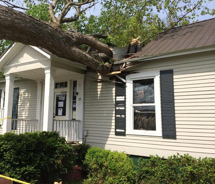
In a major storm practically anything can become a creator of damage to your home or business. Think about trees. Your home may survive storm damage only to have a tree on your property succumb to the wind, hail, or rain and fall onto your house. A neighbor’s outdoor lawn furniture can become wind-blown projectiles. Extreme wind pressure turns regular outdoor items into tools of destruction.
Hail Damage
11/1/2018 (Permalink)
Are you aware that during a hail storm more than just your vehicles are potentially vulnerable to damage and future repairs? When hail hits, it can damage the roof or covering of your home as well as other personal property. Although hailstorms can be destructive, the amount of damage can vary greatly. Following are some factors that affect the type and degree of damage that may be impacted by a hailstorm, as well as a guide on how to identify hail damage to different types of shingles and roofing materials.
- Wind – During a hailstorm, wind direction and wind speed can vary. Changes in wind conditions can affect the location and severity of hail impacts.
- Size and density – The size of the hailstones can affect the degree of damage, if any, to your property. A hailstone can be as small as a pea, or as large as a softball. Most hailstones do not have smooth edges, which can impact the type of damage they cause.
- Building materials – Building materials absorb hail impacts differently. For example, hail can cause dings in aluminum siding, gutters or asphalt shingles, whereas it can crack vinyl siding or wood shakes. Alternatively, softball-sized hailstones can be dense enough and strong enough to puncture a roof. Additionally, the age and condition of a roof could affect the degree of damage.
- Barriers– The position of neighboring structures and natural barriers, like tree cover, landscaping, fences or adjacent homes can reduce the ability of hail to cause damage.
There are many other types of damage to shingles that can be mistaken for hail damage. For example, exposure to inclement weather and sunlight makes shingles brittle and gives them an aged appearance. This type of damage is normal wear and tear of shingles, which is sometimes misidentified as hail damage. Other types of normal wear and tear may include blistering, cracking, granule loss, flaking and algae. Manufacturing defects and mechanical imperfections in shingles can also be mistaken for hail damage.
If you believe your home has sustained damage from hail, call your agent or insurance representative to discuss possible next steps.
How to Donate & Volunteer to Help Hurricane Florence Victims
9/20/2018 (Permalink)
When disaster strikes, people come together to help. To make the most of your contributions, consider these tips from FEMA for donating and volunteering responsibly:
How to Donate Successfully:
1. Provide a financial contribution to a voluntary organization involved in disaster activities.
2. Find out what services state government is providing via Website or state donations hotline.
3. Do not begin collecting, packing or shipping until or unless you have a known recipient to accept it.
How to Volunteer Successfully:
1. Get training before the next disaster.
2. Connect and affiliate with a voluntary organization.
3. Consider volunteering for the long-term community recovery.
4. Check with your local Volunteer Center for volunteer opportunities in your own community ( 1-800-Volunteer).
5. Plan to be as self-sufficient as possible (go to www.ready.gov for assistance in developing your plan).
For more information, click here.
Hurricane Florence Stats & How You Can Help
9/13/2018 (Permalink)
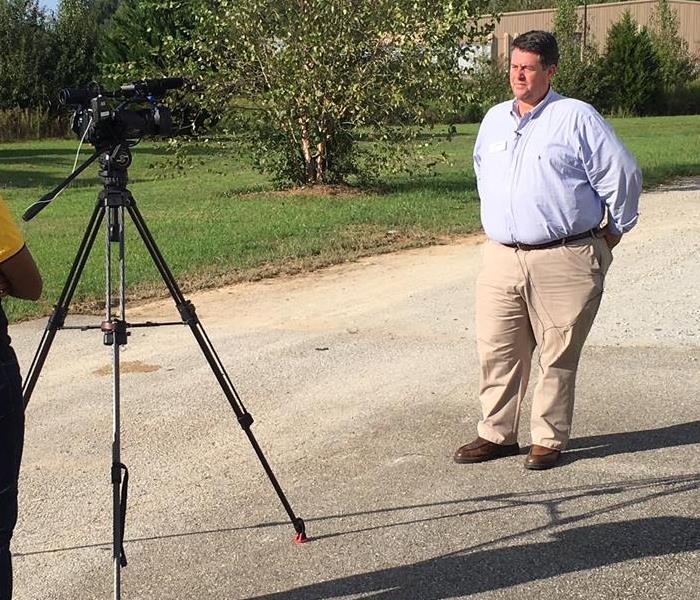
 Our Key Accounts Manager, Bubba Roby, spoke with WAFF 48 News about storm cleanup for Hurricane Florence.
Hurricane Florence is likely to cause significant flooding and wind destruction in the Carolinas and Virginia. There is also high risk of inland flooding in NC, SC and VA due to Hurricane Florence slowly moving through the weekend. Over 3 feet of rain is possible in some locations.
In addition to the 90 local Franchises in the Hurricane Florence affected areas, SERVPRO also has a national network of over 1,700 Franchises across the country. Franchises like ours are preparing to send crews to help with cleanup efforts. Our sister franchises in Huntsville, SERVPRO of South Madison County and SERVPRO of North Madison County, are also sending crews.
Here are some facts that show the power of this monster of a hurricane:- The tropical storm-force winds stretch more than 335 miles, which is far enough to reach from New York to nearly Toronto.
- The hurricane-force winds extend 80 miles from the center of the storm and cover more than 15,000 square miles, an area larger than Massachusetts, Connecticut and Rhode Island combined.
- The size of the hurricane-force winds has doubled over the past 48 hours despite the top wind speed weakening from 130 mph to 105 mph.
- Rainfall could reach 40 inches in isolated locations of coastal North Carolina. For comparison, Washington, D.C., averages 40 inches of rain in an entire year.
- Wilmington, North Carolina, has already had its rainiest year to date and could get eight months' worth of rain in the next three days. The rainfall would shatter all-time records for the region.
As the rest of the country watches the East Coast prep for Hurricane Florence, you may be wondering if there's anything you can do to help. Volunteer fire departments in the Shoals are collecting donations for hurricane victims. Donations can be dropped off at the Lexington VFD or the Nitrate City VFD. You can also make a donation.
You Can Help By Making a Donation Today!
The American Red Cross is working around the clock along the East Coast to help the thousands of people whose lives have been affected by Hurricane Florence.
Click HERE to make a donation.
Source: CNN
Scattered Afternoon Thunderstorms
6/4/2018 (Permalink)
 Hot and humid with scattered afternoon thunderstorms - another summer day in Alabama.
Scattered afternoon thunderstorms are a common way of life here in North Alabama during the summer months. If you had a dollar for every time you've heard that phrase on the weather forecast, you could retire early and quite comfortably.
Here are some facts about thunderstorms you can use to impress your friends, co-workers, or kids.
- The typical thunderstorm is 15 miles in diameter and lasts an average of 30 minutes.
- Nearly 1,800 thunderstorms are happening at any moment around the world. That's 16 million a year!
- Every thunderstorm produces lightning, which kills more people each year than tornadoes.
- You can estimate how many miles away a storm is by counting the number of seconds between the flash of lightning and the clap of thunder. Divide the number of seconds by five to get the distance in miles.
- The lightning is seen before the thunder is heard because light travels faster than sound.
- Most thunderstorms form between 2:00 and 10:00 p.m.
- A severe thunderstorm has winds at least 58 miles per hour or hail at least three-fourths of an inchin diameter.
- The Gulf Coast averages between 100 and 110 days per year with thunder reported, which eastern and northwest Alabama have 70 to 80 thunderstorm days per year.
- Occasionally, thunderstorms are severe with frequent lightning and large hail – the central and northern parts of Alabama are most vulnerable to this type of storm and are especially prone to tornadoes.
- Alabama ranks seventh in the number of deaths from lightning and ninth in the number of deaths from lightning strikes per capita.
Check out this previous blog post for safety tips and follow us on Twitter for more facts and tips.
Frozen Sprinkler Pipes
1/17/2018 (Permalink)
 Every winter thousands of sprinkler pipes freeze and burst because of lack heat or inadequate insulation.
We received over 100 calls from customers with frozen and busted pipes earlier this month. Several area businesses had water damage when the lines in their fire protection sprinklers frozen and burst. Our crews provided water damage restoration services for a restaurant in Sheffield, a dentist/oral surgery center in Sheffield and a nonprofit organization in Tuscumbia after the sprinkler pipes froze and burst.
When water freezes, it expands up to 10 percent in volume. Sprinkler pipes tend to freeze before other water pipes because the water is not moving. When a frozen sprinkler pipe bursts, the result is always extensive water damage. Where the pipe bursts and the time it takes to shut off the water will influence the amount of water damage to the property.
If your business has experienced water damage because of frozen sprinkler pipes, this is the first indication that you need additional freeze protection to prevent this from happening again. The following points will help reduce the risk of frozen sprinkler pipes.
- Maintain heat in all buildings and units
- Require an annual service and maintenance contract on all fire sprinkler systems
- Provide additional insulation for pipes in unheated areas such as attics
- Install water flow alarms to alert occupants that water is flowing in the sprinkler system
- Install freeze alarms to warn of potential freezing conditions before the pipes freeze
Additional information on freeze protection is available through the National Fire Protection Association (www. nfpa.org).
Put A Quarter In Your Freezer
11/1/2017 (Permalink)
Power outages are common during a storm, which means the electricity in a freezer is not keeping the food cold. It can be difficult to determine if a power outage occurred if you were not present during the storm. One away to determine whether the food in your freezer needs thrown out is by using a quarter or other coin. Freeze a cup of water before evacuating your home and put a quarter on top of the frozen water. If the quarter is sunk to the bottom of the cup after the storm, you should dispose all food stored in the freezer. The quarter sinking to the bottom means the food in the freezer has defrosted and it should be thrown out. This is a great method to determine if your food went bad in your home.
Fun Things To Do In A Power Outage
11/1/2017 (Permalink)
Here in the Tennessee Valley, storms often lead to power outages. Here are some activity ideas for fun things to do in a power outage.
- Create shadow puppets on the wall using a flashlight
- Draw pictures in the dark and then laugh at your creations once the lights come back on
- Pack some new books into your activity kit and then have a story time with flashlights
- If the power goes out during the day, enjoy the fresh air with some outdoor play
- Create pictures or secret messages using glow in the dark paint pens
- Play a board game, card game or complete a puzzle (if it’s dark, you’ll have to play by a flashlight)
- Write a letter to a friend or family member that lives far away
- Pack a portable radio, batteries and glow sticks for a glow in the dark dance party
- Pack some old pictures and scrapbook supplies and create some new pages for your scrapbook
- Have a puppet show. No puppets? No problem! Find printable online or DIY ones to make with your family.
- Create cards like thank you cards, birthday cards or get well soon cards that you can use later
- Have a fun ice cream sundae party – because you don’t want that ice cream to melt in the freezer!
- Have a picnic with flashlights, juice boxes and granola bars
- Play with Play-Doh
- Host a tea party for your family and favorite stuffed animals
- Have a silly photo shoot using wigs and old Halloween costumes
- Play hide & seek with flashlights
- Play with bubbles outside. Find DIY instructions online to make your own bubbles with dish soap!
Don’t forget to repack your kit after each use so that it’s ready again for your next power outage or rainy day!
Also, don't forget that Florence Utilities now has real-time updates of any power outages in Florence, Killen, Rogersville and the rest of their services area.
Visit http://florenceelectricityoutage.com
Thunderstorm Safety
9/21/2017 (Permalink)
Thunderstorm Safety In Northwest Alabama
Thunderstorms occur throughout the year in the Shoals area. They are most common in the summer, but most severe in the spring and fall, when destructive winds and tornadoes occasionally occur.
If thunderstorm and lightning are occurring in your area, you should:
- Use your battery-operated NOAA Weather Radio for updates from local officials.
- Avoid contact with corded phones and devices including those plugged into electric for recharging. You can use cordless and wireless phones not connected to wall outlets.
- Don’t go near electrical equipment or cords. Unplug appliances and other electrical items such as computers. Turn off air conditioners. Power surges from lightning can cause serious damage.
- Stay away from the plumbing. Don’t wash your hands, take a shower, wash dishes or do the laundry. Plumbing and bathroom fixtures can conduct electricity.
- Stay away from windows and doors. Stay off porches.
- Do not lie on concrete floors. Don’t lean against concrete walls.
- Avoid natural lightning rods such as a tall, isolated tree in an open area.
- Try to stay away from hilltops, open fields, the beach or a boat on the water.
- Take shelter in a sturdy building. Avoid isolated sheds or other small structures in open areas.
- Don’t touch anything metal—tractors, farm equipment, motorcycles, golf carts, golf clubs and bicycles.
- If you are driving, try to safely exit the roadway and park. Stay in the vehicle and turn on the emergency flashers until the heavy rain ends. Try not to touch metal or other surfaces that conduct electricity in and outside the vehicle.
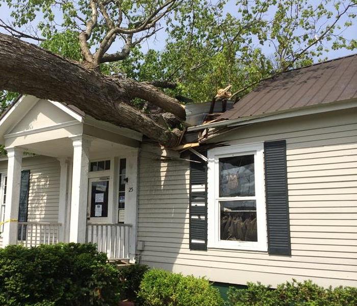
What Happens If Your Neighbor's Tree Falls on Your House?
9/14/2017 (Permalink)
 Straight-line winds are common during a thunderstorm and can cause considerable damage, even in the absence of a tornado.
Yes, windstorm damage is covered on a standard homeowner's insurance policy. But whose homeowner's insurance policy covers the loss?
First, it is important to understand what windstorm insurance policies cover. Windstorm insurance is a special type of property and casualty insurance designed to cover damages caused by high winds. Windstorm insurance may cover damages from hurricane-force winds, tornadoes, hail and other weather events that are accompanied by wind gusts that exceed 35 miles per hour.
A hypothetical tree falls on your house.
- Scenario 1: Your tree falls on your house. Your homeowner's policy will provide coverage up to your policy limits, after you pay the deductible. The coverage extends to cover damage to your main home, garage, shed or other additional buildings and structures such as a fence. If there is damage to the structure of the house, debris removal is also covered, up to policy limits.
- Scenario 2: Your tree falls on your neighbor's house. The basic rule is that the insurance policy of the property that was damaged pays for the loss.
- Scenario 3: Your neighbor's tree fell on your house. Your homeowner's insurance policy should pay for any damage per the property claim.
- Scenario 4: A tree falls on your car. The comprehensive coverage of the vehicle owner’s auto policy will apply. As in the examples above, generally the owner of the tree is not responsible.
Please note that homeowners insurance usually won't cover a loss caused by negligence or a maintenance-related issue. So if the tree was rotting and ready to fall down before the storm, homeowners insurance likely would not cover the damage the tree caused to your home.
When Storms or Floods hit Muscle Shoals, SERVPRO is ready!
6/5/2017 (Permalink)
 Our highly trained crews are ready to respond 24/7 to storm or flood damage in Muscle Shoals.
SERVPRO of the Quad Cities specializes in storm and flood damage restoration. Our crews are highly trained and we use specialized equipment to restore your property to its pre-storm condition.
Faster Response
Since we are locally owned and operated, we are able to respond quicker with the right resources, which is extremely important. A fast response lessens the damage, limits further damage, and reduces the restoration cost.
Resources to Handle Floods and Storms
When storms hit Muscle Shoals, we can scale our resources to handle a large storm or flooding disaster. We can access equipment and personnel from a network of 1,650 Franchises across the country and elite Disaster Recovery Teams that are strategically located throughout the United States.
Have Storm or Flood Damage? Call Us Today 256-383-4470
Flood Damages and Flood Insurance In North Alabama
1/19/2017 (Permalink)
In North Alabama we know how drastic the weather can be and how suddenly it can change. Also, for the cities like Florence and Muscle Shoals have properties that are near the Tennessee River putting the homes and businesses in jeopardy of flooding. It is important to know the terms associated with flooding and what kind of coverage you have on your home.
Flood Terms:
- Flood Watch: Flooding is possible.
- Flash Flood Watch: Flash flooding is possible. Be prepared to move to higher ground.
- Flood Warning: Flooding is occurring or will occur soon; if advised to evacuate, do so immediately.
- Flash Flood Warning: A flash flood is occurring; seek higher ground immediately.
Knowing About Flood Insurance:
- Regular homeowners insurance does not cover flood water damages and when purchased from you insurance company is ran through the National Flood Insurance Program.
- If there is sewage back up caused by a flood then it would be only be covered by flood insurance.
- Upon the purchase of flood insurance there is a 30 Day waiting period before the insurance kicks in, so it is important to plan ahead.
- Find out if you are in a flood plain. If you are not you want to calculate the risk of not having flood insurance.


 24/7 Emergency Service
